Fig. 2
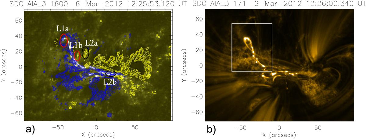
Images of AR NOAA 11429 and flaring loops. Panels a) and b) show the entire map of the AR in 1600Å and 171Å emissions, respectively. Blue and yellow areas represent positive and negative values of the LOS magnetic field, respectively. The highlighted magnetic field varies in absolute value between the lower threshold of 500 Gauss and upper limit of 1000 Gauss. L1a and L1b (encircled by red ellipses) show the foot points of the L1 loop; while L2a and L2b (encircled by black ellipses) indicate the foot points of the L2 loop, respectively. In panel b), the rectangular polygon shows the location of the studied flaring loops.
Current usage metrics show cumulative count of Article Views (full-text article views including HTML views, PDF and ePub downloads, according to the available data) and Abstracts Views on Vision4Press platform.
Data correspond to usage on the plateform after 2015. The current usage metrics is available 48-96 hours after online publication and is updated daily on week days.
Initial download of the metrics may take a while.