Fig. 5
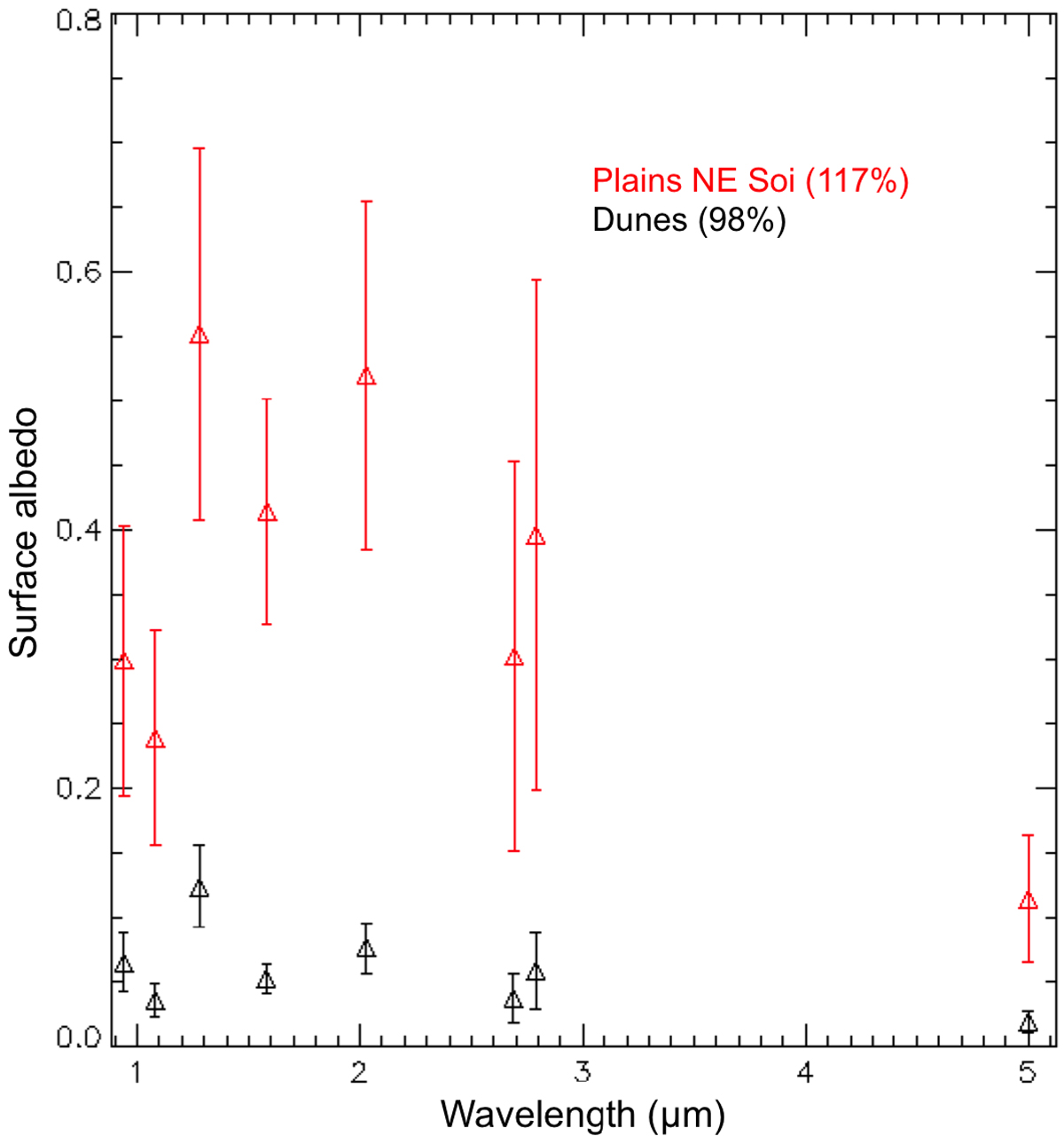
Weighted surface albedo of the undifferentiated plains NE of Soi crater (133°W, 30°N) (red triangles) and the dunes of the Belet sand sea (237°W, 5°N) (black triangles). This figure shows results from the data analysis presented in Solomonidou et al. (2016, 2018) and Lopes et al. (2016), provided as context for the present work. The percentages next to the names in the labels correspond to the haze contributions to the data with respect to Huygens’ Descent Imager/Spectral Radiometer (DISR) measurements.
Current usage metrics show cumulative count of Article Views (full-text article views including HTML views, PDF and ePub downloads, according to the available data) and Abstracts Views on Vision4Press platform.
Data correspond to usage on the plateform after 2015. The current usage metrics is available 48-96 hours after online publication and is updated daily on week days.
Initial download of the metrics may take a while.