Fig. 4
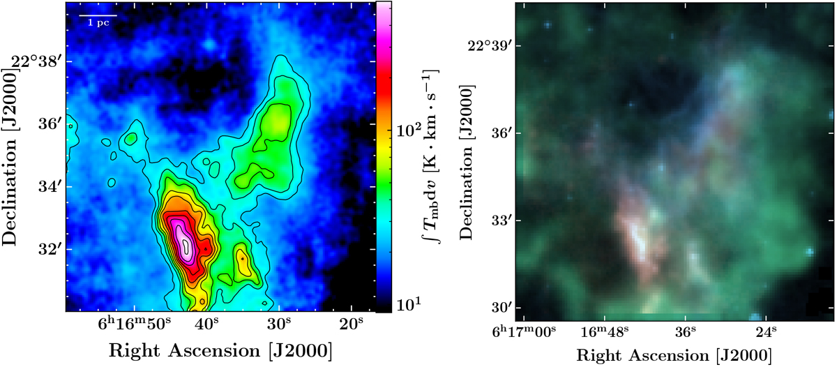
Left: 0th moment of the 12CO(2–1) observationscarried out with the IRAM 30 m over the extended G region. This map corresponds to the signal integrated in the velocity interval [−40; +30] km s−1. The color scale used to represent data is logarithmic to enhance the dynamic range and emphasize the fainter molecular cloudlet. Right: composite image of our field of observations in the extended G region, using an IRAM 30 m data cube as well as Spitzer-MIPS data; 12CO(2–1) ([−40, +30] km s−1 as in the left panel) is coded in red, MIPS-24 μm in blue, and 13CO(1–0) [−4.0, −2.5] km s−1, corresponding to the emission spatially and kinematically associated with the ambient cloud described by Lee et al. (2012) in green. Color scale levels are based on the minimum and maximum value of each map.
Current usage metrics show cumulative count of Article Views (full-text article views including HTML views, PDF and ePub downloads, according to the available data) and Abstracts Views on Vision4Press platform.
Data correspond to usage on the plateform after 2015. The current usage metrics is available 48-96 hours after online publication and is updated daily on week days.
Initial download of the metrics may take a while.