Fig. 1
Download original image
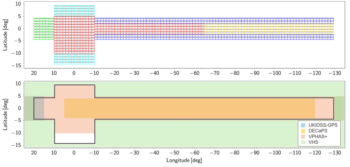
VVV+VVVX survey coverage of the MW bulge and southern plane. Top: the surveyed area shown Galactic coordinates. Our near-IR survey covers ~1700 sq. deg. in total, and the different regions are colour-coded according to the location, baseline, and number of observations (see Sec. 4). In red is the original VVV Bulge and VVV Disk, with observations from years 2010 and 2016 using the ZY JHKs filters, and VVVX observations between years 2016 and 2022 using the JHKs filters. Other colours mark the VVVX areas, observed with JHKs filters between years 2016 to 2022. Yellow is the Disk to Longitude +230, dark blue is the Low and High Extended Disk, green is the Disk to Longitude +20, and in light blue is the Low and High Extended Bulge. A zoomed view of the image with the tile names is presented in Appendix A. Bottom: Schematic representation of the areal coverage compared with the other selected complementary surveys mentioned in Sect. 1.
Current usage metrics show cumulative count of Article Views (full-text article views including HTML views, PDF and ePub downloads, according to the available data) and Abstracts Views on Vision4Press platform.
Data correspond to usage on the plateform after 2015. The current usage metrics is available 48-96 hours after online publication and is updated daily on week days.
Initial download of the metrics may take a while.