Fig. B.1.
Download original image
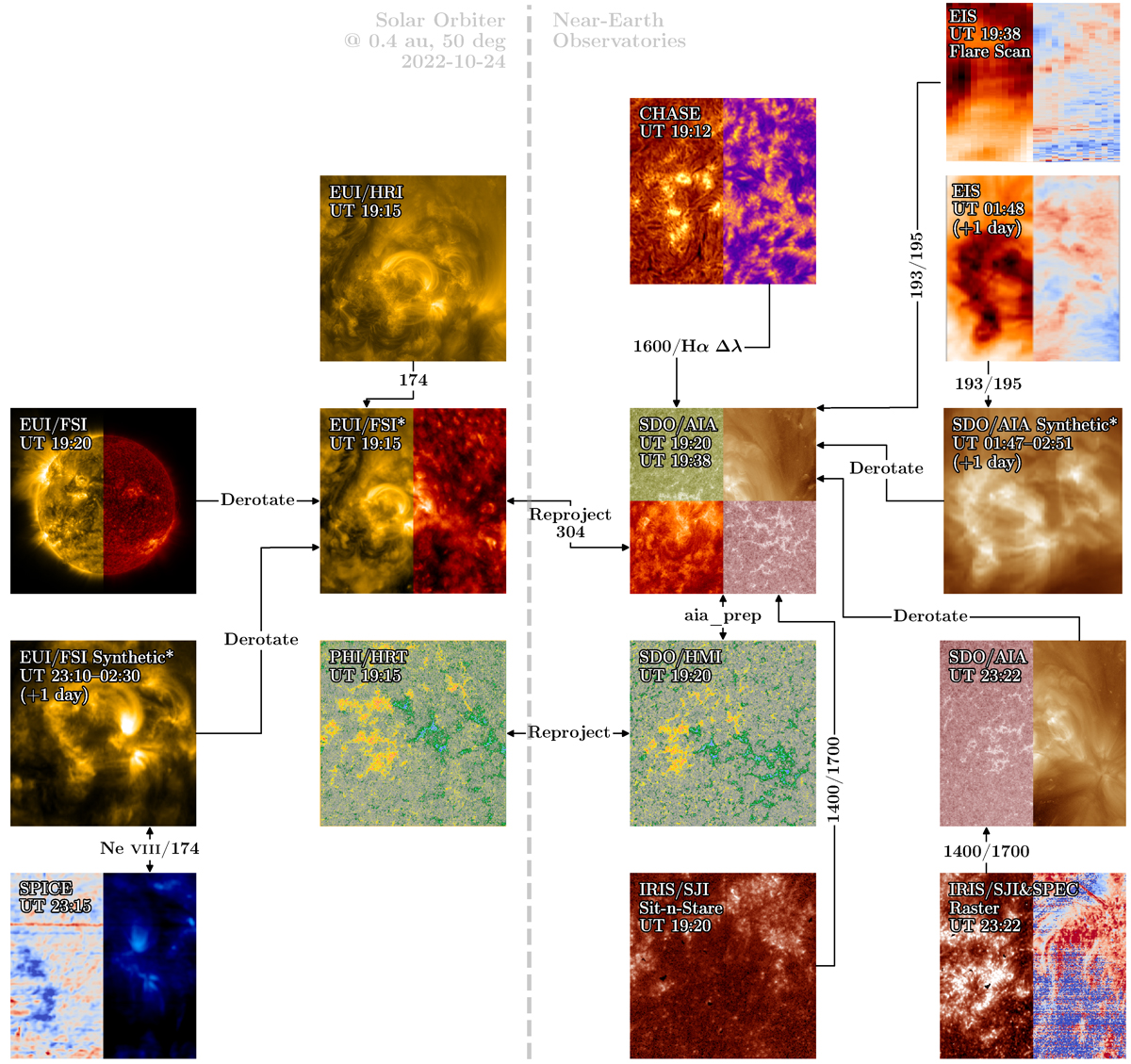
Example of coaligning observations made by Solar Orbiter and other near-Earth observatories on 2022 October 24 and October 25. Arrows connect the maps coaligned with each other. “Derotate” means the maps observed at different times are coaligned after the removal of solar rotation. Maps connected by arrows with “reproject” undergo projection from one helioprojective frame to another before coalignment. Annotations with slash denote that we cross-correlated the two instruments using these channels or spectral lines; for example, “1400/1700” means IRIS and AIA are coaligned by comparing IRIS/SJI 140.0 nm channel and AIA 170.0 nm channel. Maps with an asterisk (*) are reprojected maps, either to remove solar rotation or to create a single synthetic raster image from a series of images. Link to the Jupyter notebook creating this figure: 📘.
Current usage metrics show cumulative count of Article Views (full-text article views including HTML views, PDF and ePub downloads, according to the available data) and Abstracts Views on Vision4Press platform.
Data correspond to usage on the plateform after 2015. The current usage metrics is available 48-96 hours after online publication and is updated daily on week days.
Initial download of the metrics may take a while.