Fig. 2
Download original image
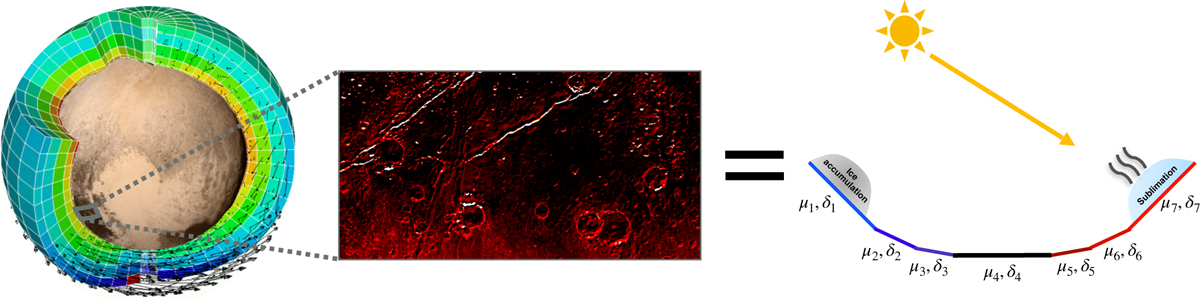
Schema of the subgrid-scale slope parameterization. Each coarse mesh of the global Pluto Volatile Transport Model/Pluto Planetary Climate Model (left) is decomposed into north-south facing subgrid slopes (defined by characteristic slopes μi; right) or flat terrain. Each of these subgrid surfaces is associated with its cover fraction δi, which represents the percentage of the mesh grid occupied by a given slope μi within the observed local topography (middle). These subgrid terrains have their own microclimate (insolation, surface, subsurface temperatures, condensation/sublimation of frosts, etc.), and the interactions between the atmosphere and surface are made through averaged values over the mesh. The bluish surfaces on the right show slopes that are colder than the flat surfaces (and warmer for reddish surfaces).
Current usage metrics show cumulative count of Article Views (full-text article views including HTML views, PDF and ePub downloads, according to the available data) and Abstracts Views on Vision4Press platform.
Data correspond to usage on the plateform after 2015. The current usage metrics is available 48-96 hours after online publication and is updated daily on week days.
Initial download of the metrics may take a while.