Open Access
Fig. 3
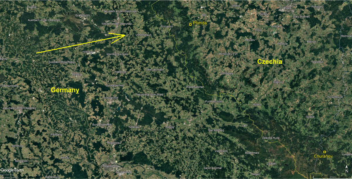
Download original image
Ground projection of recorded atmospheric trajectory (yellow arrow) of the EN131212_041258 Geminid fireball and location of the Czech stations Přimda and Churáňov where its records were taken. The average slope of the atmospheric trajectory was 54.7° and its length was 81.9 km (source of the map: Google Earth).
Current usage metrics show cumulative count of Article Views (full-text article views including HTML views, PDF and ePub downloads, according to the available data) and Abstracts Views on Vision4Press platform.
Data correspond to usage on the plateform after 2015. The current usage metrics is available 48-96 hours after online publication and is updated daily on week days.
Initial download of the metrics may take a while.