Fig. 23
Download original image
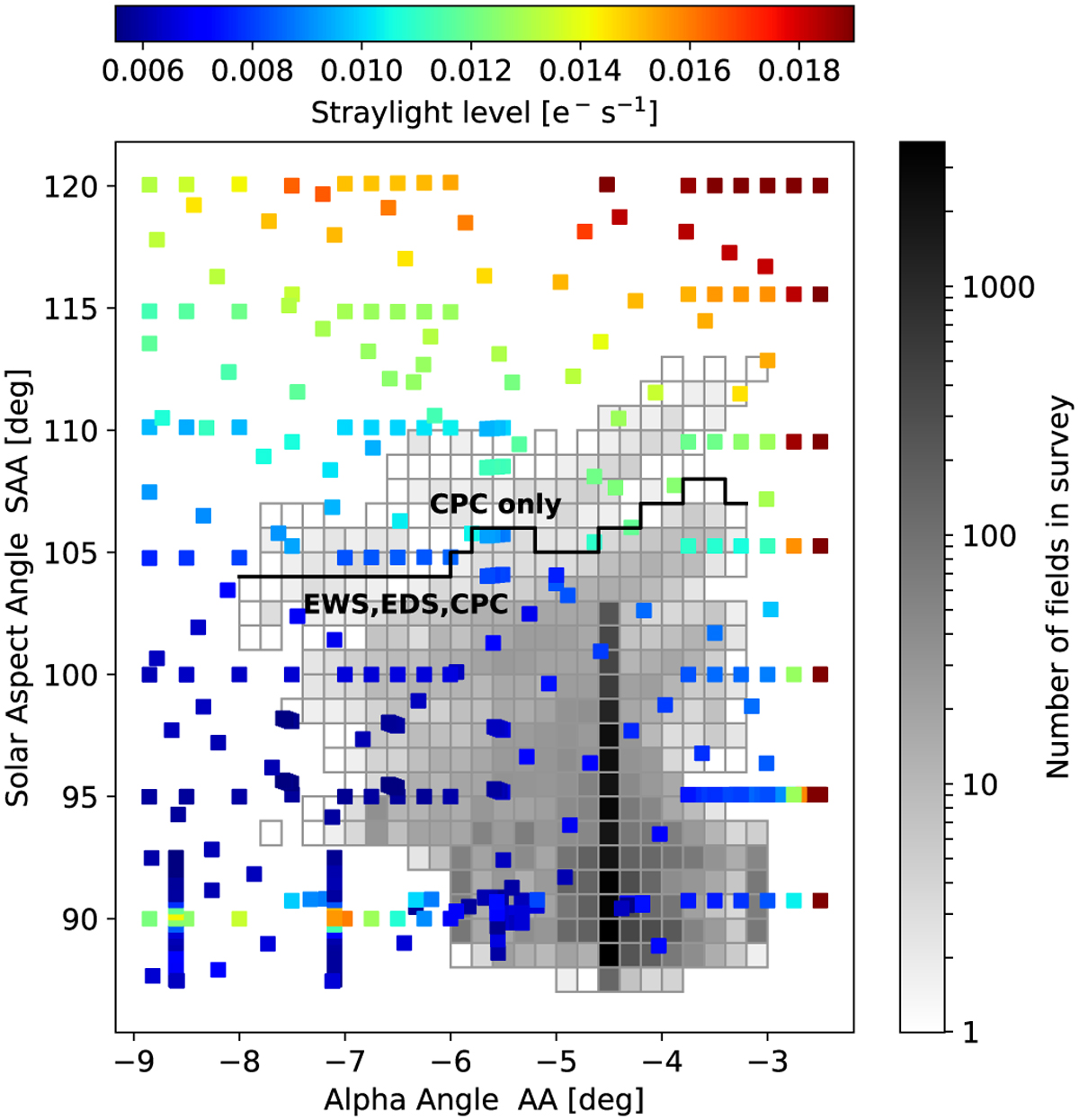
Stray light map and survey fields. The coloured squares show the stray light level in VIS dark exposures as a function of spacecraft orientation angles. The log-scaled greyscale map shows the density of fields in the latest survey configuration including calibrations. The survey minimises stray light over the EWS and EDS, with the majority of the observations to be taken at AA = ![]() . The CPC fields are NISP-specific and include higher SAA positions (above the jagged black line); while NISP is not affected by stray light, parallel VIS observations must still be taken.
. The CPC fields are NISP-specific and include higher SAA positions (above the jagged black line); while NISP is not affected by stray light, parallel VIS observations must still be taken.
Current usage metrics show cumulative count of Article Views (full-text article views including HTML views, PDF and ePub downloads, according to the available data) and Abstracts Views on Vision4Press platform.
Data correspond to usage on the plateform after 2015. The current usage metrics is available 48-96 hours after online publication and is updated daily on week days.
Initial download of the metrics may take a while.