Fig. 3
Download original image
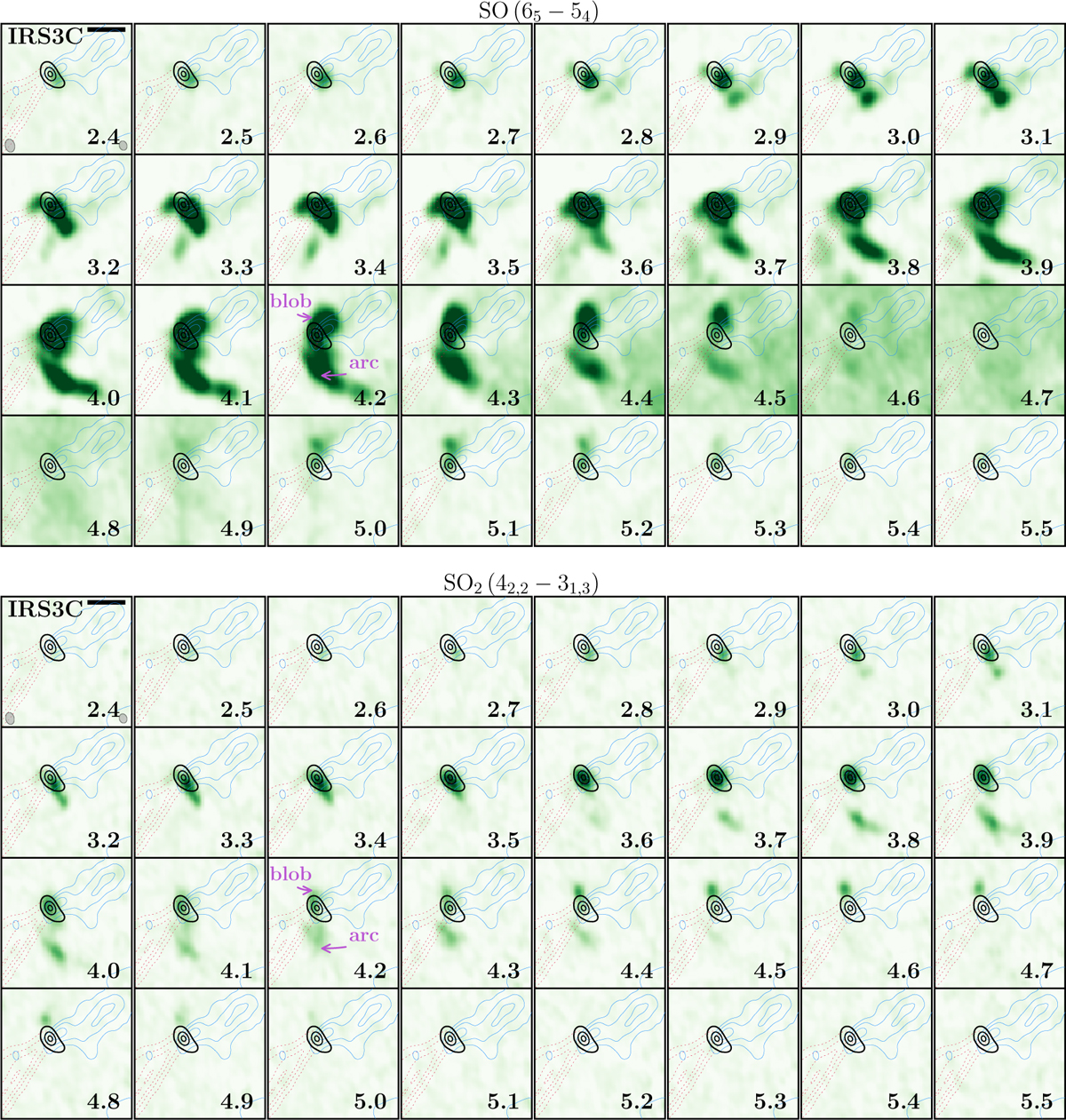
Channel maps of SO 65 - 54 (top, merged data) and SO2 42,2 - 31,3 (bottom, NOEMA-only data) toward L1448 IRS3C. The green color map shows the line intensity with the velocity of the channel in km s-1 labeled in the bottom right. The black contours are the same as in Fig. 1. The dashed red and solid blue contours indicate the CO (2 - 1) integrated intensity of the red- and blueshifted outflow launched by IRS3C. The integration ranges are 5.9-27 km s-1 and 2-3.4 km s-1 (narrow range to avoid foreground contamination) with contour levels at 0.1, 0.3, 0.5, and 0.7 and 0.5, 0.7, and 0.9 times the peak-integrated intensity, respectively. In the top left panel, the black scale bar in the top right corner indicates a spatial scale of 1 000 au. The synthesized beam of the line and continuum data are shown in the bottom left and right corners, respectively. In each panel, the scale is set from a minimum brightness temperature of -0.3 K to a maximum of 7 K. The IRS3C source velocity is 3.8 km -1 (Sect. 3.3).
Current usage metrics show cumulative count of Article Views (full-text article views including HTML views, PDF and ePub downloads, according to the available data) and Abstracts Views on Vision4Press platform.
Data correspond to usage on the plateform after 2015. The current usage metrics is available 48-96 hours after online publication and is updated daily on week days.
Initial download of the metrics may take a while.