Fig. 4
Download original image
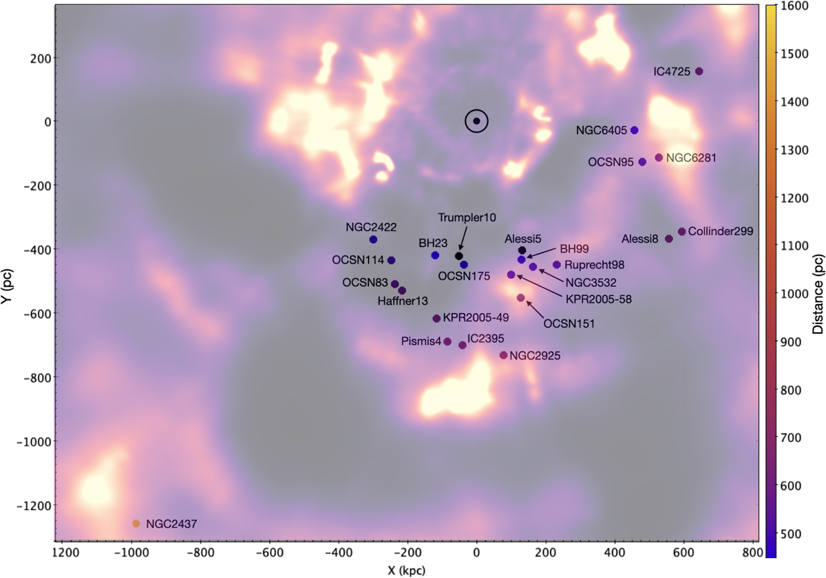
Cluster positions projected onto the Galactic plane. The extinction map from Zucker et al. (2025) is overplotted. Interstellar clouds are shown in yellow, and clear regions are shown in black. The cluster IDs are labeled and color-coded according to their distances using the scale shown on the right. The Sun is marked with a dotted circle, and the clusters, Galactic center, and bulge are located right of this diagram. All the distances are in parsecs. Most clusters have clear lines of sight, largely free from extinction. The exceptions are NGC6405, NGC6281, OCSN95 and OSCN151, that lie behind moderately optically thick dust clouds.
Current usage metrics show cumulative count of Article Views (full-text article views including HTML views, PDF and ePub downloads, according to the available data) and Abstracts Views on Vision4Press platform.
Data correspond to usage on the plateform after 2015. The current usage metrics is available 48-96 hours after online publication and is updated daily on week days.
Initial download of the metrics may take a while.