Fig. 2.
Download original image
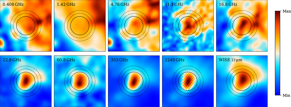
Morphology of high-latitude source G159.02-33.88 in selected maps consisting of a collection of dark clouds, including LDN 1454/53/58 and DOBASHI 4162. The solid circle (72′ radius) marks the primary aperture, while the dashed annulus (96′–120′) represents the background region. The grid spans 6.7° per side. The AME component is visible above 5 GHz, with a strong correspondence between the WMAP K-band (22.8 GHz) near the AME peak and the DIRBE 240 μm (1249 GHz) map near the thermal dust peak. The reprocessed WISE 12 μm PAH-dominated map from Meisner & Finkbeiner (2014) is also shown. The color scale is linear and has been normalized to the pixel range of each image.
Current usage metrics show cumulative count of Article Views (full-text article views including HTML views, PDF and ePub downloads, according to the available data) and Abstracts Views on Vision4Press platform.
Data correspond to usage on the plateform after 2015. The current usage metrics is available 48-96 hours after online publication and is updated daily on week days.
Initial download of the metrics may take a while.