Fig. 1
Download original image
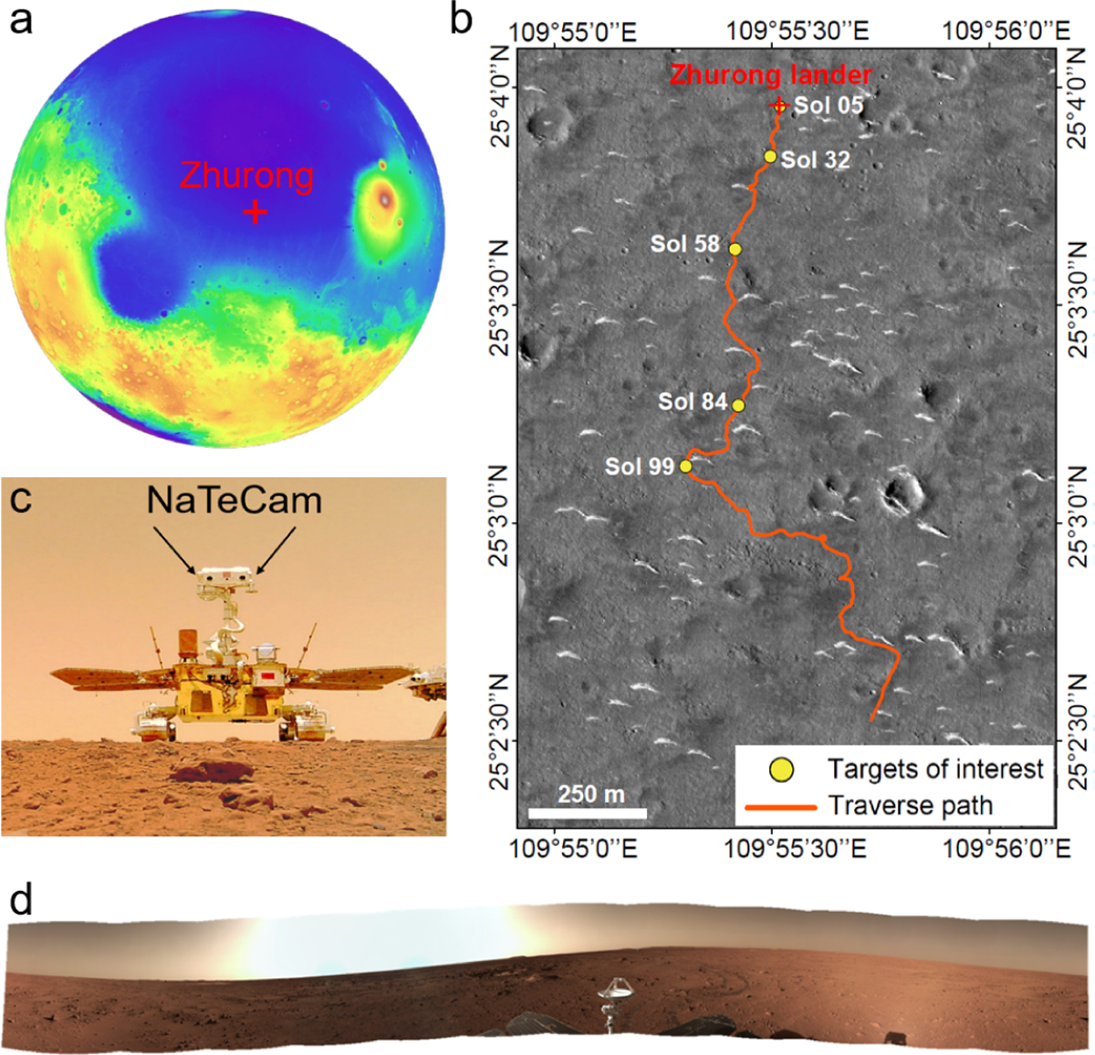
Location of the Zhurong landing site and NaTeCam datasets. (a) Location of the Zhurong landing site, overlaid on a MOLA digital terrain model. (b) Traverse path of Zhurong and locations of the acquired panoramic NaTeCam datasets, overlaid on a Tianwen-1 High-Resolution Imaging Camera (HiRIC) image (HX1_GRAS_HIRIC_DIM_0.7_0004_251515N1095850E_A). (c) Zhurong rover selfie and the position of NaTeCam on the rover; the selfie was taken by a small detachable camera carried by the rover. (d) 360° panoramic image acquired by NaTeCam on Sol 32.
Current usage metrics show cumulative count of Article Views (full-text article views including HTML views, PDF and ePub downloads, according to the available data) and Abstracts Views on Vision4Press platform.
Data correspond to usage on the plateform after 2015. The current usage metrics is available 48-96 hours after online publication and is updated daily on week days.
Initial download of the metrics may take a while.