Fig. 11
Download original image
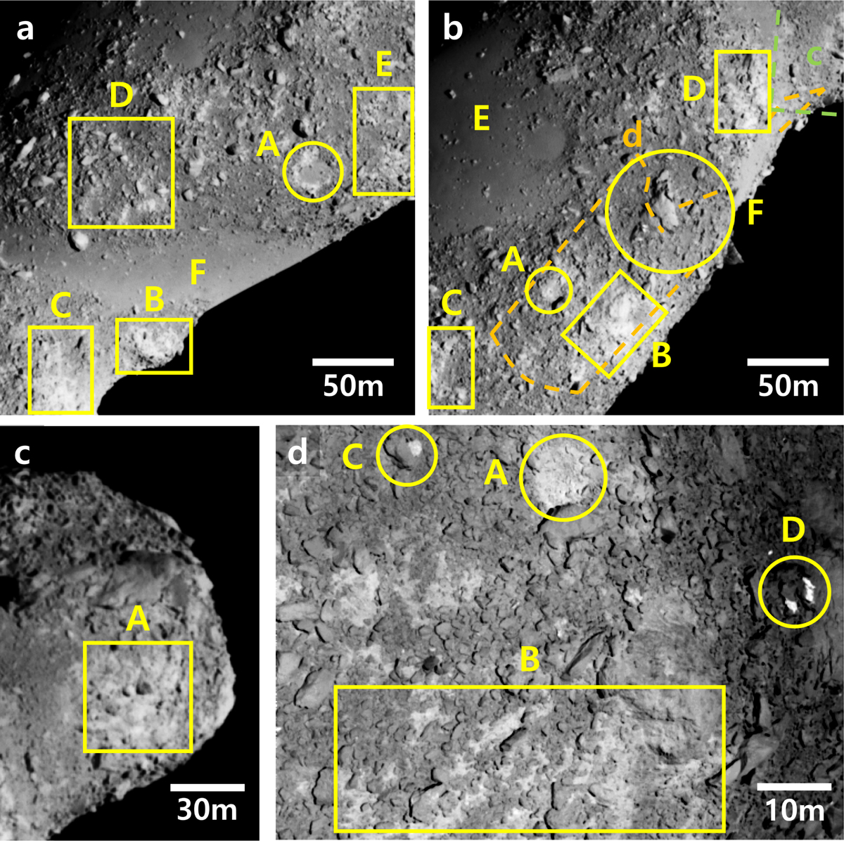
High-resolution images of Itokawa taken by Hayabusa/AMICA. (a) Eastern (opposite) side of Itokawa (image ID: ST_2487335302). This image includes the Komaba crater with a bright rim (A), fresh surfaces on steep slopes along the Yatsugatake ridge (B), Shirakami (C), and other fresh patches near large boulders or craters (D, E). The large smooth terrain, Muses Sea, is also shown (F). (b) Western (Kamoi) side (image ID: ST_2486649845). Locations of panels (c) and (d) are marked with orange and green dashed lines, respectively. Notable features include the Kamoi crater (A), fresh surfaces near the Kamoi crater (B, C) and in the neck region (D), the mature smooth terrain Sagamihara Planitia (E), and another smooth area near the Tsukuba boulder (F). (c) Head region (image ID: ST_2483892216), showing relatively fresh terrain near a black boulder (A). (d) Close-up near the Kamoi crater (image ID: ST_2566571276), showing the crater (A), fresh basins around weathered boulders (B), and boulders with very fresh surfaces likely fractured by impact or thermal fatigue (C, D).
Current usage metrics show cumulative count of Article Views (full-text article views including HTML views, PDF and ePub downloads, according to the available data) and Abstracts Views on Vision4Press platform.
Data correspond to usage on the plateform after 2015. The current usage metrics is available 48-96 hours after online publication and is updated daily on week days.
Initial download of the metrics may take a while.